Around the World in a (Simulated) Airplane, Part 6 : Turks & Caicos Islands
Get link
Facebook
X
Pinterest
Email
Other Apps
-
As I expected when I started this round-the-world blog, flight-simulator technology would improve remarkably along the journey...
This entry is a re-issue of an earlier post, introducing the photo-realistic add-on Ortho4XP (which existed before, but I hadn't started using.) In the next blog entry, I'll also introduce the new Microsoft Flight Simulator 2020.
I ended up pausing this blog throughout 2020, hugely distracted by Covid and, even more so, pulled into many directions, evaluating Ortho4XP (leading to this with/without side-by-side comparison video), other add-on's, and the new Microsoft simulator. But, now, finally back in motion!
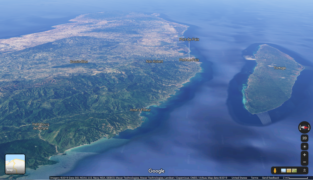
Flying over the island of Tortuga. In the background, across the channel, is mainland Haiti
After leaving behind the relatively large Tortuga island, it's 100 Km (60 miles) of open Atlantic Ocean, and then a series of very flat, oddly shaped small islands, starting with Inagua Island, which is the southernmost (and very easterly) part of the Bahamas.
Turks and Caicos Islands are a British Overseas Territory consisting of the larger Caicos Islands in the western parts, and the smaller Turks Islands in the east. They comprise 8 main islands and more than 22 smaller ones.
In case you wonder what's with the "Turks" in the name, given that this place is a world away from the country of Turkey – I had the very same question! According to this article, one theory is that the name originates from “where the Turks gather” : in those days, Turks was a reference to pirates, because some Ottoman ships were involved in piracy. Another theory, disputed by some, is that Europeans first sighting the islands saw on the horizon what seemed to be red Persian turbans – but in fact were a red-capped cactus, whose common names include “Turk’s Head Cactus.”
Celebrities in the Turks & Caicos Islands (Source)
After a stopover on an aircraft carrier, my initial landfall is in the Caicos Islands, which constitute the western part of the archipelago. From there, I visit the rest of this island nation proceeding eastward.
The island of Providenciales, in the western part of Turks and Caicos Islands. This is WITHOUT the Ortho4XP add-on: the color of the water is rather uniform. Notice the small airport near the center. Contrasted with Google Earth, below
Trying to approximate the previous view in Google Earth (live map)
Exploring the island of Providenciales, in the western part of the Turks and Caicos Islands
Some time after my initial exploration of these islands, I returned – this time with the power of the add-on Ortho4XP, which makes beaches more beautiful with realistic colors based on aerial or satellite images.
The images in this section make use of this add-on. Notice how the water color is no longer uniform, and also the lines are softer and more realistic-looking.
Notice any difference from the previous image?!
One flight, 10 emotions! Done with the Ortho4XP add-on. Best watched full-screen, at high-res. I put to good use my music collection!
Back to Hispaniola: to the North Coast of Dominican Republic
Time for another ocean crossing, 160 Km (100 miles), back to the island of Hispaniola, this time on the Dominican Republic side.
Note that we're now back to images WITHOUT the Ortho4XP add-on. From height, the difference is nowhere as pronounced.
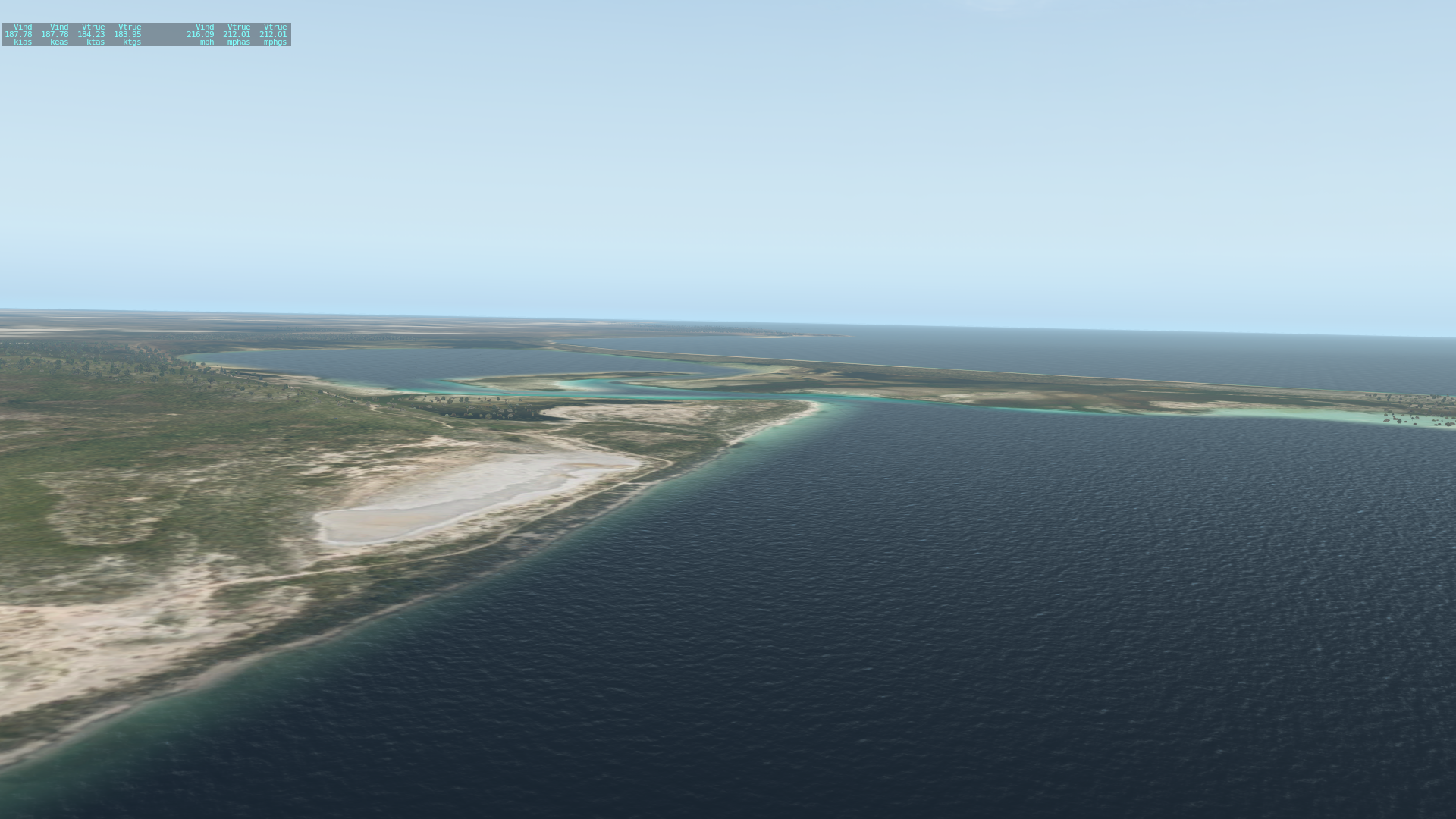
A lot of open sea around Salt Cay (triangular shape, center) and Grand Turk Island (right), part of the Turks Islands, at the eastern end of the island nation
Leaving behind the Turks and Caicos Islands
A lot of open Atlantic ocean, heading south back towards the Dominican Republic, on the large island of Hispaniola
Catching sight of an aircraft carrier
Don't try this with a real airplane!
Briefly catching a ride towards the Dominican Republic on the aircraft carrier
In part 4 and part 5 we explored the western side (mostly Haiti) of the large island of Hispaniola; in the upcoming part 7, we will cross the tall mountains on the eastern side, in the Dominican Republic.
AIRPORTS: Cap Haitien, Haiti (MTCH) ; West Caicos (MBWC) ; Providenciales, Caicos Islands (MBPV) ; Osvaldo Virgil Airport, Dominican Republic (MDMC)
COMING SOON! Part 7 : Crossing the Mountains of the Dominican Republic.
"Divine Potatoes" is my nickname for a fabulous vegetarian dish - reminiscent of samosa filling - that my equally-fabulous housemate Palak can, to my surprise, whip out with amazing ease... a dish for which she says there's no name. Hence my nickname! I think it deserves a "Michelin star"! (a prestigious culinary award.) Do we dare to re-create it? Fasten your seat-belts, and let's jump in! SHORT VERSION : boiled potatoes with Indian-style gravy. LONG VERSION : the full recipe is 1,862 pages long, and requires a 10-year apprenticeship to master, but here's an executive summary :) The following recipe is scaled for smallish portions for 6 people . ------------------- TRACK 1 (start here, because it takes longer) - the POTATOES . 3 or 4 medium (Russet) potatoes. Peel and slice into small-ish cubes; put into water and boil until moderately soft. Then drain the water with a colander. ------------------- PARALLEL TRACK 2 ...
See the above region on Google maps HOT NEWS! I'm pleased to a announce the launch of a new YouTube channel called "A rt of Virtual Flight " , with flight-simulator videos that are somewhat longer and more elaborate than most of the short clips featured in the early entries of this blog. Typically 1-2 mins long, from a number of scenes, with cuts matched to a musical score that I apply. I had edited video professionally for years – so, time to put that skill to good new uses! A little down the line, I will open the channel to guest submissions ; I'll post guidelines as soon as the direction of the channel is more established... Heading Inland to the North Coast Having reached the south coast of Dominican Republic after crossing southern Hispaniola in part 4 , I turn north and slightly backtrack westward (into Haiti) to reach the north coast of the island, the 2nd largest one in the Caribbean. For an overview of the journe...
[UPDATED APR. 2025] A lot of my friends express amazement at the various festivals I take them to. How do I know about them? Some are obscure and yet absolutely incredible! Well, it has been a process of exploration over the years... All the photos here are casual snapshots or video stills taken by me. BEST FESTIVAL AWARD - The Greek Festival in the Oakland hills This festival brings out happiness, as evidenced by my friend Andrea In May . The awesome views of the Bay from the top of the Oakland hills complement the yummy food, the dance shows, arts, crafts, clothing, jewelry, history, music, architecture, participatory folk dance, etc. The event takes place on a plaza surrounding a Greek Orthodox church; some of it is outdoors, and some indoors. The admission fee is very modest ($6 , or $5 in advance.) The food tends to be a tad better on Saturday; if you go on Sunday, don't wait too late, because many food items run out....


Comments
Post a Comment