So, I'm planning to go around the world, starting in Miami - and I'm still in Cuba... I'd better step on it! In part 1, we left off on a cluster of little islands off the north coast of Cuba, east of Havana.
While heading south, halfway through crossing the narrow side of Cuba, someone in my household turned on her hair dryer, and overloaded the
circuits: the computer rebooted and I lost the flight, grrr!
But in the Grand Scheme of Things, it was perhaps a good thing: it
motivated me to learn how to pilot a faster airplane, the slightly-larger Beechcraft Baron 58. I can now zip along at speeds around 200 knots (230.156 mph or 370 Km/h), instead of chugging along at a meager 130 knots (150 mph or 240 Km/h.)
Approaching the north coast of mainland Cuba in the new airplane type
Crossing mainland Cuba north-to-south in the roomier airplane (Beechcraft Baron 58)
Arriving at the opposite (south) coast of Cuba upon crossing the island : notice the cove on the left
Same view of the above cove (Ensenada Sobanalamar), in Google Earth
Resting at a small airport near the south coast of Cuba
Across the Caribbean Sea, to the Cayman Islands
Leaving Cuba in the early morning
Here's a video snippet of the early-morning takeoff; the lighting and reflections created by the simulator are just incredible!
The colorful round instrument on the left is the speed gauge: you can see the buildup of speed prior to takeoff. The large black gauge, two instruments to the right, is the altimeter (in feet, above sea level.) In the compass (above the dashboard, in the center), you can see that we're headed east, into the rising sun; then we turn to the right, southward. [Music: "Chateau Saint Martin", from "The Ninth Gate"]
Venturing across the Caribbean Sea, still with the golden light of early morning, catching sight of a small island off the south coast of Cuba
Approaching the 2 smaller Cayman Islands (Cayman Brac, left, and Little Cayman)
Around the Cayman Islands
About 190 Km (120 miles) off the southern coast of Cuba lie the Cayman Islands, a British Overseas Territory notorious as a tax haven.
It's a group of 3 main islands: the peaks of a massive underwater ridge. The first ones I approach flying in from Cuba are the two smaller ones: Cayman Brac and Little Cayman.
The "Bluff" (by the sandy beaches) on the eastern end of Cayman Brac
Tourist promo image for Crystal Caves, on the largest island, Grand Cayman (Source)
I managed to find a well-produced, sexy video about diving in the Cayman Islands:
Off To Jamaica
Time to leave Grand Cayman behind, headed for Jamaica, 300 Km (200 miles) to the south-west:
After a layover in Little Cayman, taking off at the crack of dawn, on the way to Jamaica
Re-visiting Cayman Brac in passing. Notice the lit runway
Just the open water of the Caribbean Sea for a while
Landfall in western Jamaica, by Negril, on a tiny airstrip (straight ahead) that strained my landing skills!
AIRPORTS: Jardines Del Rey, Cuba (MUCC) ; Florida, Cuba (MUFL) ; Sir Captain Kirkconnell, Gerrard Smith Bay, Cayman Brac Island (MWCB) ; Own Roberts, George Town, Grand Cayman (MWCR) ; Bodden Field, Little Cayman (MWCL) ; Negril, Jamaica (MKNG)
"Divine Potatoes" is my nickname for a fabulous vegetarian dish - reminiscent of samosa filling - that my equally-fabulous housemate Palak can, to my surprise, whip out with amazing ease... a dish for which she says there's no name. Hence my nickname! I think it deserves a "Michelin star"! (a prestigious culinary award.) Do we dare to re-create it? Fasten your seat-belts, and let's jump in! SHORT VERSION : boiled potatoes with Indian-style gravy. LONG VERSION : the full recipe is 1,862 pages long, and requires a 10-year apprenticeship to master, but here's an executive summary :) The following recipe is scaled for smallish portions for 6 people . ------------------- TRACK 1 (start here, because it takes longer) - the POTATOES . 3 or 4 medium (Russet) potatoes. Peel and slice into small-ish cubes; put into water and boil until moderately soft. Then drain the water with a colander. ------------------- PARALLEL TRACK 2 ...
See the above region on Google maps HOT NEWS! I'm pleased to a announce the launch of a new YouTube channel called "A rt of Virtual Flight " , with flight-simulator videos that are somewhat longer and more elaborate than most of the short clips featured in the early entries of this blog. Typically 1-2 mins long, from a number of scenes, with cuts matched to a musical score that I apply. I had edited video professionally for years – so, time to put that skill to good new uses! A little down the line, I will open the channel to guest submissions ; I'll post guidelines as soon as the direction of the channel is more established... Heading Inland to the North Coast Having reached the south coast of Dominican Republic after crossing southern Hispaniola in part 4 , I turn north and slightly backtrack westward (into Haiti) to reach the north coast of the island, the 2nd largest one in the Caribbean. For an overview of the journe...
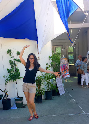
[UPDATED APR. 2025] A lot of my friends express amazement at the various festivals I take them to. How do I know about them? Some are obscure and yet absolutely incredible! Well, it has been a process of exploration over the years... All the photos here are casual snapshots or video stills taken by me. BEST FESTIVAL AWARD - The Greek Festival in the Oakland hills This festival brings out happiness, as evidenced by my friend Andrea In May . The awesome views of the Bay from the top of the Oakland hills complement the yummy food, the dance shows, arts, crafts, clothing, jewelry, history, music, architecture, participatory folk dance, etc. The event takes place on a plaza surrounding a Greek Orthodox church; some of it is outdoors, and some indoors. The admission fee is very modest ($6 , or $5 in advance.) The food tends to be a tad better on Saturday; if you go on Sunday, don't wait too late, because many food items run out....


Comments
Post a Comment